


Itinerary 4 - Towns, Forests and Castles
32
km
35
stops
45'
duration
32
km
35
stops
45'
duration
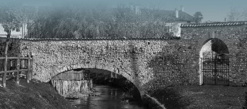
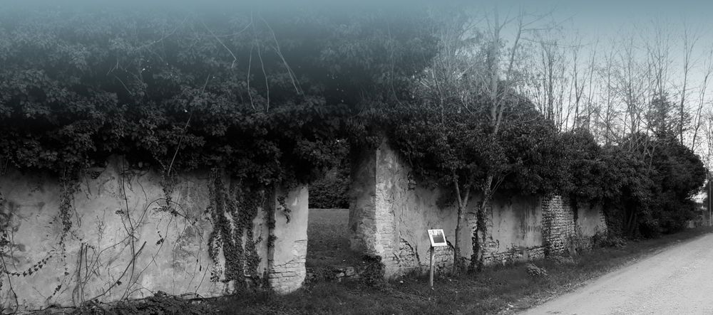
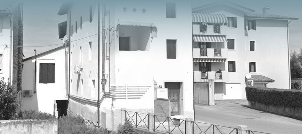
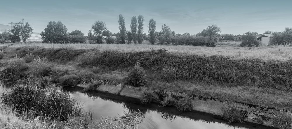
Arzene - Itinerary 4 departure
Rural village
The name of the locality ("embankment") is linked to its location on the edge of the Meduna river, which until the mid-nineteenth century flowed near the town. But the reference could also be to the western branch of the Tagliamento which has now disappeared.
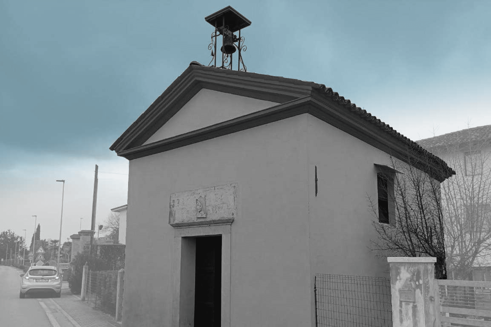
St. Margaret's Church in Arzene
A church dedicated to Margaret, the girl who defeated the dragon
The building was originally built in the year 1000 but was rebuilt in the 16th century. Recently, the façade was restored to reveal the stones and bricks. Above the wooden altar is a painting by Pomponio Amalteo depicting Saint Margaret alongside Saints Sebastian and Rochus. Underneath, the artist added scenes illustrating Saint Margaret's martyrdom and her triumph over the dragon.
Historic center of Valvasone
The Wolf's Castle
The village grew around the castle and progressively expanded in the Middle Ages with the construction of more city walls. Nowadays the town has managed to maintain the original urban layout, with characteristic alleys and numerous historic buildings, which has earned it entry into the restricted circuit of the "most beautiful villages in Italy".
Brolo of the former convent
A green corner in the medieval village
Where today there is a small square, there once stood a church, which in the fifteenth century was combined with a first convent (of the Servites) and in the eighteenth century a second one (of the Dominicans) was added. Today only the cloister of the latter survives, recovered in the 1980s following a restoration. And behind it there is a large and pleasant lawned garden, one of the most particular corners in all of Valvasone.
Perspective on the village of Valvasone
Meeting between city and countryside
In the altarpiece preserved in the church of Sant'Antonio, the protector of the church shows the faithful devoured by fire and intercedes towards God. Just above a saint shows the city of Valvasone as if it were on a tray. The image by the anonymous painter shows the castle and the urban sectors seen from the south.

Majaroff Mill
The Fairy Mill
It is a historic mill, once owned by the Counts of Valvasone, situated on the Roggia dei Mulini. Originally, it had three water wheels for grinding wheat and barley, which were later replaced by a turbine. Over the centuries, it has been modified multiple times and underwent a historical restoration in 1976. According to old folk tales, fairies would magically appear here in the evening, playfully tricking the wagon drivers, and disappear at the sound of the morning Ave Maria bells.
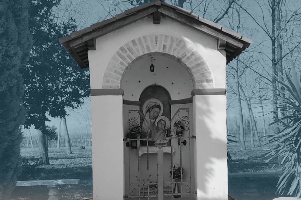
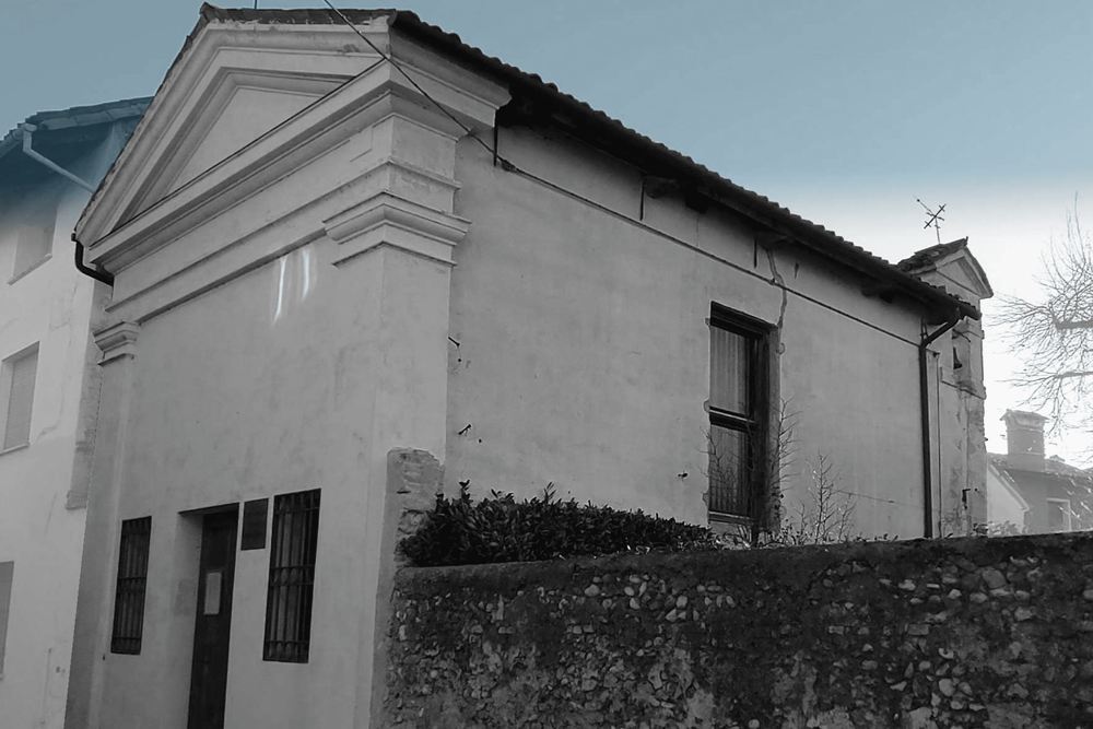
St. Anne's capital
Protection against wolves
Saint Anne, to whom the small field chapel is dedicated, was a beloved saint in the wolf-infested countryside. Up until the 18th century, wolves posed a real threat, particularly to children who were in charge of leading the flocks to pasture. Until quite recently, the chapel was a cherished devotional destination for women from all over the area who gathered here to pray the rosary and seek blessings for milk after childbirth.
Via Postumia
The ancient connection between Genoa and Venice
The Via Postumia was a Roman consular road built in 148 BC. by the Roman consul Postumius Albinus, who crossed the entire Po Valley, at the time called Cisalpine Gaul. The road extended for 634 miles, approximately 932 km, connecting the two main ports of the time in the northern Mediterranean (Genoa and Aquileia) and connecting cities such as Tortona, Piacenza, Cremona, Verona and Vicenza.
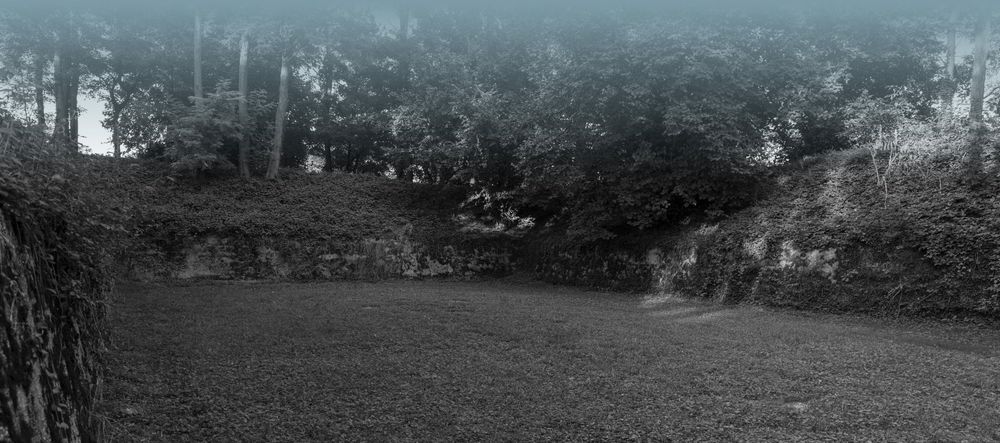
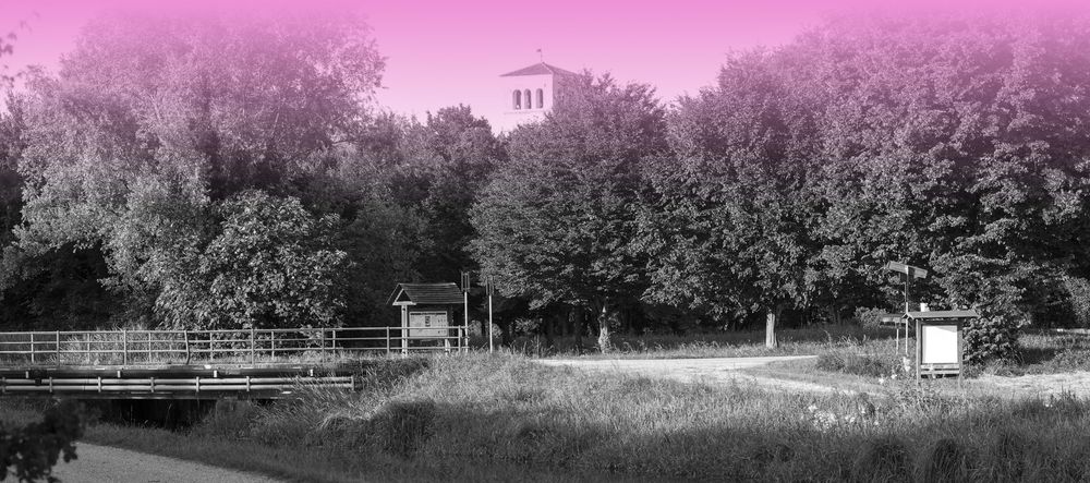
Former powder magazine
Where explosives were stored during the Great War
An old military area, dating back over a hundred years, has been recovered by the Alpine troops and is now a nature-historical park open to all.
Signs of ancient springs (Roggia Mussa springs)
The beautiful country among the canals
The Municipality of Casarsa is located along the line of the resurgences which demarcates the border between the upper and lower Friulian plains. In the historical period, the spaces along the canals were mowed because they had a higher fodder production than other fields given that the constant temperature of the water also mitigated the effects of frost.
Rural settlement of Casarsa
The missed church but not forgotten
The materials from the demolished place of worship were repurposed in the nearby parish church. Today, this fact is commemorated by special paving in Piazza Cavour. The notable plaque, initially placed there as a votive offering after narrowly escaping the Ottoman invasion in 1499, is now preserved in the little church known as Glisiut di Santa Croce.
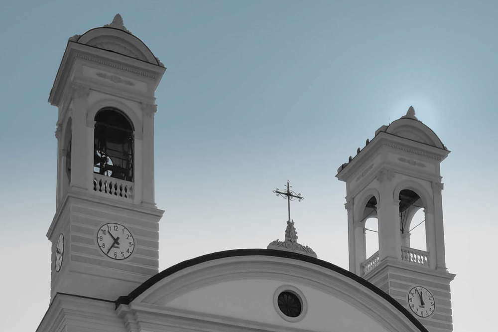
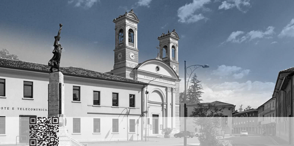
Church of the Holy Cross and the Blessed Virgin of the Rosary
The church with twin steeples
While it feels as though we are in Rome, we are actually in the heart of Friuli. At the end of the 19th century, Casarsa needed a larger parish church for its growing community and drew inspiration from the renowned model of Santissima Trinità dei Monti in the capital city.
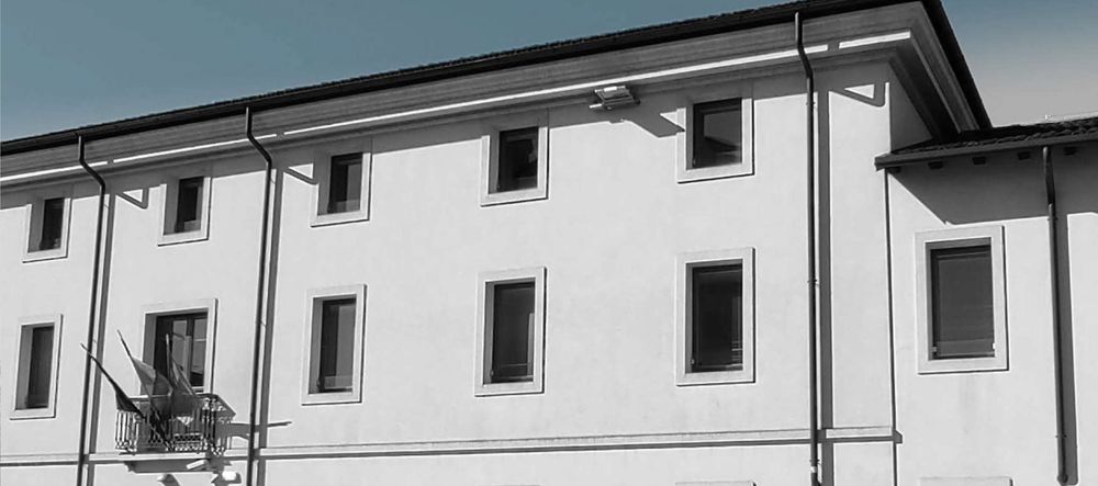
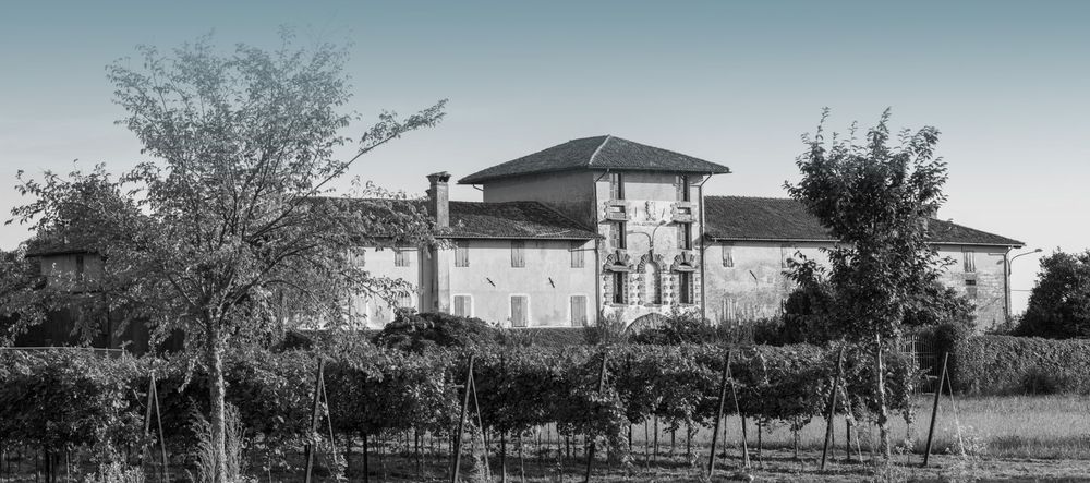
Palazzo Burovich de Zmajevich
The Count's residence barchesse and an orangery
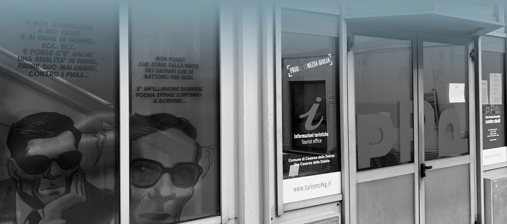
Colussi Pasolini's house
The birthplace of Pier Paolo Pasolini's mother
Casa Colussi is where Pier Paolo Pasolini's mother was born and where he found refuge during World War II from 1943 to 1950. Here, Pasolini started his writing career with his first literary work, 'Poesie a Casarsa'. In 1945, he and his friends founded 'Academiuta di Lenga Friulana' (Academy of Friulian Language) in this building.
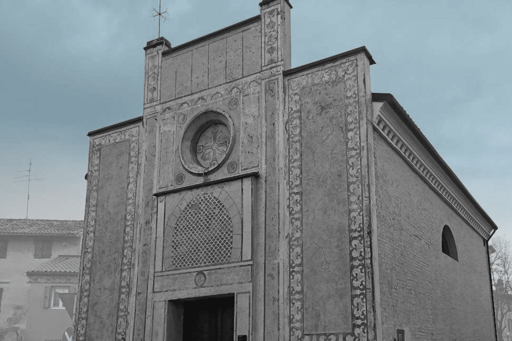
Church of the Holy Cross - Glisiut
The heart of a community's faith
The church of the defensive curtain, the first nucleus of today's Casarsa, was beautifully frescoed during the Renaissance by Pomponio Amalteo, the son-in-law of Il Pordenone (who was the inspiration for the work). Although the 1945 bombs tragically destroyed Pasolini's cherished paintings (his coffin paused here in November 1945 before reaching the cemetery), there is now an exciting new digital project that lets us see them again.
Di Sotto Mill
The natural environment merges with the cultural one
In this area the natural environment merges with the cultural one with the natural watercourse and a small artificial lake. Before passing through a railway underpass you pass by the Rio dei mulini and you can see the precious environment of the mill below which is still well preserved.
The former cemetery of San Giovanni
Old cemeteries are evocative places
Only a few tombstones remain in the former cemeteries of San Giovanni and Casarsa, but they are still pleasant green areas for peaceful strolls.
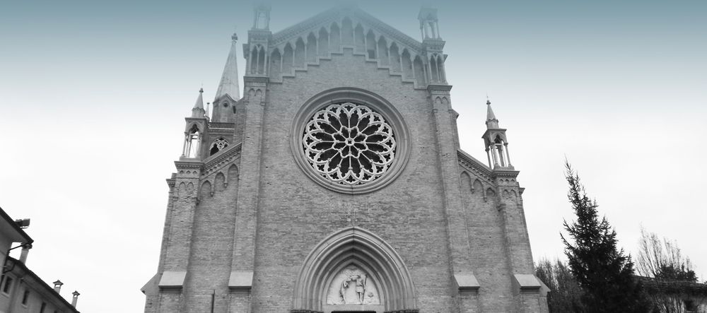
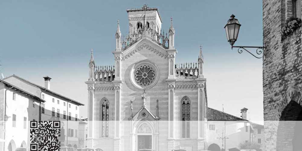
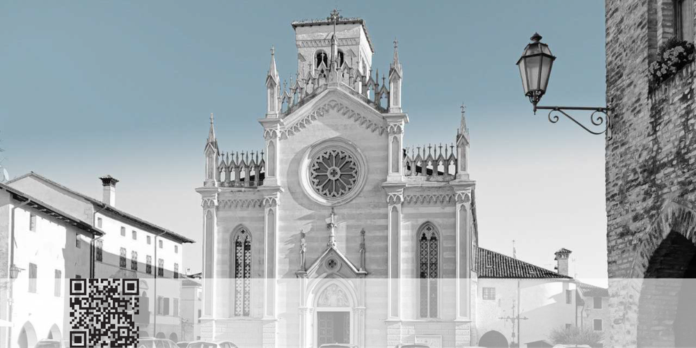
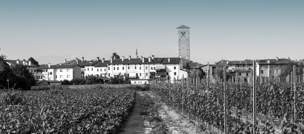
Duomo of San Giovanni di Casarsa della Delizia
Friulian Neo-Gothic art and devotion
On the site of the former parish church, which was once part of a defensive curtain wall dating back to the Longobard period and later, the construction of the impressive new cathedral began at the end of the 19th century (1896). Designed by architect Domenico Rupolo and brought to life by Girolamo D'Aronco, the cathedral was consecrated in 1908. Slightly earlier, the bell tower, designed in the Venetian style by architect Raimondo D'Aronco, was completed in 1882.
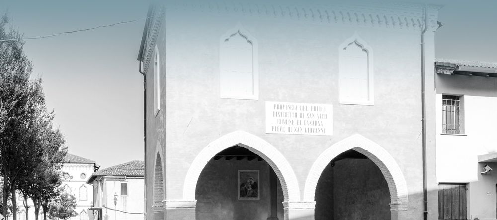
Loggia of San Giovanni
The Loggia where Pasolini would put up his posters
On Piazza Vittoria, next to the cathedral, stands an ancient Venetian-style loggia, likely dating back to the 14th century. This symbolic site for the residents of San Giovanni di Casarsa features three arches and historically served as the seat of the gastaldia, the administrative district governed by an official of the royal court to operate in civil, military, and judicial matters.
Church of Sant'Antonio Abate in Versuta
A Journey through the Middle Ages in Friuli
The oldest artistic testimony in the municipality of Casarsa della Delizia features frescoes by the Bolognese school, notably those by Tommaso da Modena, dating back to 1370-80. The statue of the saint, with the adorable piglet at his feet, warmly overlooks the scene. This place was dear to Pier Paolo Pasolini, who, with some ingenuity, uncovered some of the frescoes during World War II by simply rubbing an onion over the plaster.
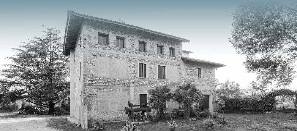
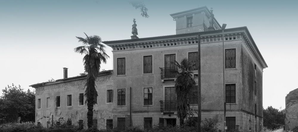
Villa Boreana
Ancient agricultural complex
The agricultural settlement of Boreana is a very particular place because it is a very particular agricultural company planned in the 17th century to colonize a complex of public lands alienated from the Serenissima.
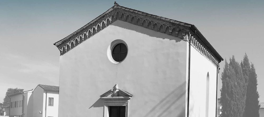
Church of Saint Sabina and Lucia
Ancient chapel of the Fontana village
This small church built between the seventeenth and eighteenth centuries is today nestled between the houses and almost hidden; but originally it constituted the chapel of the Fontana village, which developed outside the walls.
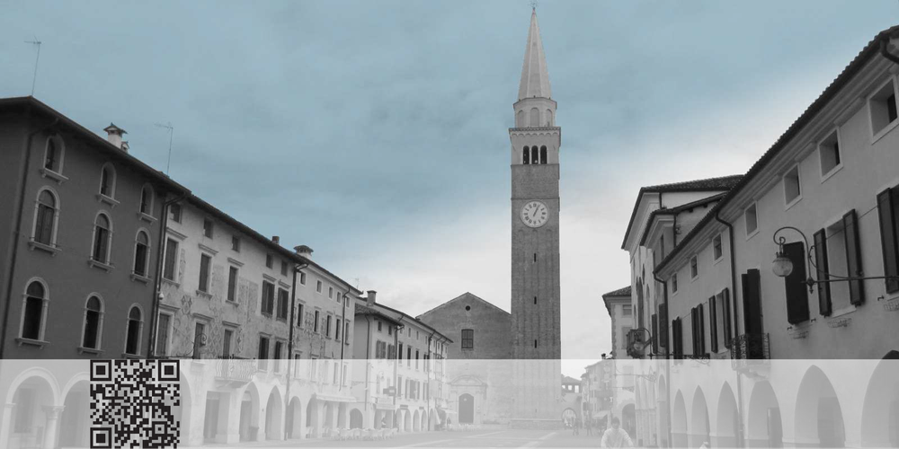
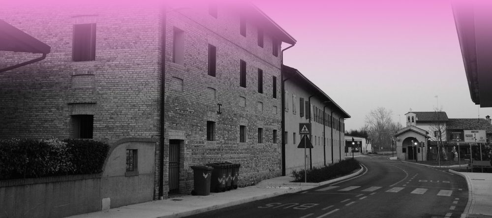
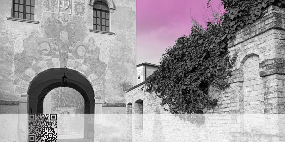
Historic center of San Vito al Tagliamento
An area inhabited since prehistoric times
The area where San Vito al Tagliamento is located has been marked by human presence since prehistoric times, as shown by the Mesolithic and Neolithic finds. The Roman age is also well documented, with numerous findings that have led to the hypothesis of the existence of a large rustic villa from the middle-imperial age in the Gorgaz area.
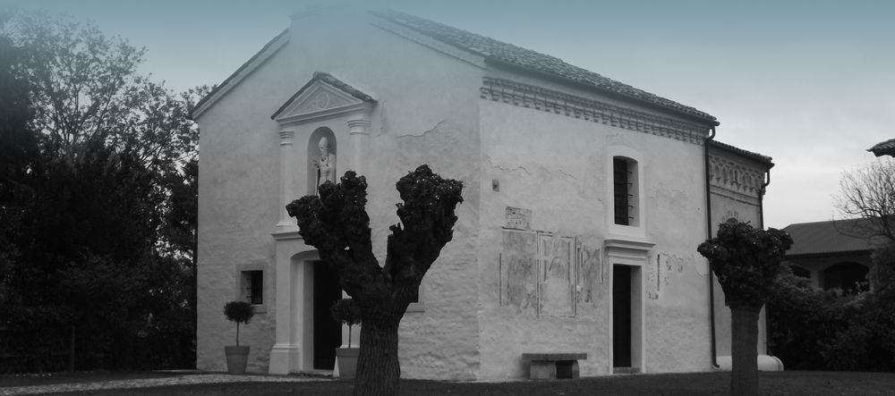
Church of St. Roch in San Vito al Tagliamento
The place of worship in Borgo Favria
Outside the historic center of San Vito, to the west, lies Borgo Favria, a rural village characterized by agricultural building typologies. Here, at a road junction, is the church of San Rocco, dating back to the sixteenth century.
Mill of the Friars of Filippo Neri
The friars' mill
In the past, the presence of the Versa canal favored the activity of various factories in Borgo Favria. Among these, the mill of the Dominican friars of San Filippo Neri. It has very ancient origins: it already existed in 1409 and at that time it was owned by the Altan family.
Church of Our Lady of Sorrows
A much loved church
The small church built near the Dominican mill is recently founded, but compared to other rural churches here it is still possible to feel a strong attachment to the cult.
Residue of stable meadow
Signs of an ancient landscape
Little or nothing remains of the old landscape of humid prairies interspersed with some more or less large woods. Today, the wetter the land, the less convenient it is to plow it and therefore little by little the tree-lined and wooded spaces are growing starting from the biotope of the historic "boscat".
Jewish Cemetery
The testimony of the Jewish presence
The economic development and political weight of San Vito during the centuries of domination of the Republic of Venice had led to the arrival of some Jewish families in the city. The cemetery was used until almost the end of the 18th century, a period which marked the end of Jewish permanence in the city.
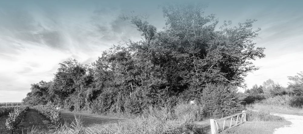
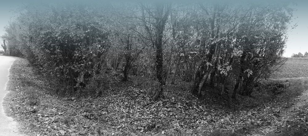
View on the Boscat
Last remnant of lowland forest in the Pordenone plain
In these sectors of the countryside the more or less intentional processes of development of a new naturalness seem to be able to prefigure new landscape structures. Along the road you can perceive in the distance the tree masses of the last remnant of the lowland forest of the Pordenone plain.
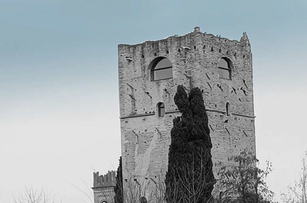
Sbrojavacca Castle
The tower that dominates the landscape
Of the original castle of Sbrojavacca today almost only the large tower about 30 meters high remains. With a square plan with sides of 8 meters and a wall thickness of over one and a half meters at the base, it was originally divided into six floors. The shape of the walls and the numerous holes present suggest that it was flanked by other buildings.
Braidacurti and the rice fields
Ancient rice field area
Probably at the end of the 17th century in the area of the Melmose marshes near Sbrojavacca a special agricultural company arose which, after deforestation, occupied large spaces of humid and uncultivable public lands. The idea was to build a company linked to the cultivation of rice.
Marignana
Example of a medieval settlement
The small rural settlement of Marignana still has the ability to give us a linear medieval settlement model. A street village oriented from north to south and located on a clay hill along the Selvata stream which had a large swamp upstream. The town was located in a high position capable of exploiting a large cultivable area of dry land.
Melmose
Historic rice fields area
This large plain is divided into Melmose di Sopra and di Sotto depending on the position of the agricultural settlements within the Roggia Selvata basin which comes from the Prodolone resurgences and which here takes on a significant size.
Burovich fields
Contrasts between tree masses and prairies
The Burovich meadows complex, named after the last owners, represents evidence of the agricultural arrangements of the 19th century. On the left of the Reghena river, patches aligned and adjacent to stable meadows, about thirty meters wide, stretch out forming large green bands, joined by trees that flank the ditches.
Historic center of Sesto al Reghena - Itinerary 4 arrival
The name Sesto stems from the existence of a statio (resting place) in Roman times, located six miles from the city of Iulia Concordia, along the road heading north.
©️ 2024: Pro Casarsa della Delizia APS via Zatti 1, 33072,
Casarsa della Delizia (PN)
Tel. +39 0434 871031
Cell. +39 338 7874972
Email segreteria@procarsa.org
PEC
procasarsa@pec.unplifvg.it
CF 91002390937 - P. IVA 01237500937 - SDI M5UXCR1
www.procasarsa.org